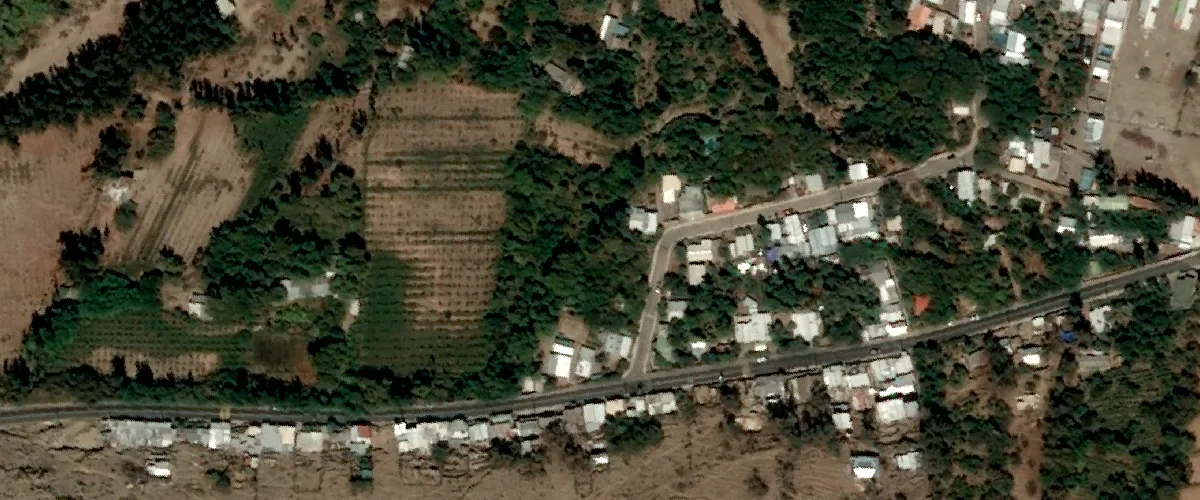
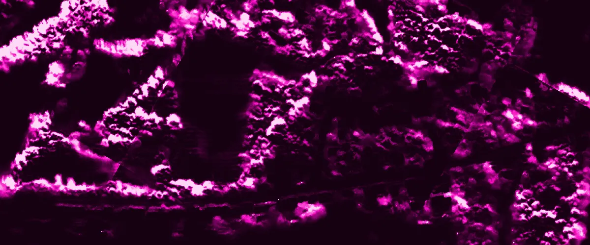
The algorithm identifies all pixels that are part of a shadow in SPOT, Pléiades, or Pléiades Neo display imagery. The result is a GeoTIFF file that maps the probability of each pixel being part of a shadow.
Shadow detection can be used for urban planning, construction, solar power planning, and land use analysis.
| Specification | Description |
|---|---|
| Provider | Spacept |
| Process type | Analytics from 420 credits per km2 |
The algorithm has been developed using tens of thousands of semantically annotated images.
The accuracy is as follows:
- For tree shadows: 95%
- For building shadows: 70%
There might be false positives in some water bodies being identified as shadows.
Input data items must be added to storage in 2023 or later.
| Collection | Data product |
|---|---|
| SPOT | Catalog: Display |
| Pléiades | Catalog: Display |
| Pléiades Neo | Catalog: Display |
Use the detection-shadows-spacept name ID for the processing API.
A sample input payload for the process
{ "inputs": { "title": "Processing imagery over Berlin", "item": "https://api.up42.com/v2/assets/stac/collections/21c0b14e-3434-4675-98d1-f225507ded99/items/23e4567-e89b-12d3-a456-426614174000" }}| Parameter | Overview |
|---|---|
inputs.title | string | required The title of the output data item. |
inputs.item | string | required The absolute API path to the input data item. |