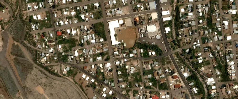
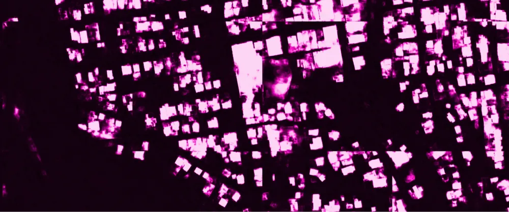
The algorithm identifies all pixels that are part of a building in SPOT, Pléiades, or Pléiades Neo imagery. The result is a GeoTIFF file that maps the probability of each pixel being part of a building.
Building detection can be used for urban planning, fire risk estimation, and land use management.
| Specification | Description |
|---|---|
| Provider | Spacept |
| Process type | Analytics from 38 credits per km2 |
The algorithm has been developed using semantically annotated imagery captured over the following countries:
- USA
- Mexico
- France
- Belgium
- Portugal
- India
- Nepal
- Indonesia
- Australia
The accuracy ranges from 80% to 90% depending on input image resolution and location. For optimal results, the algorithm must be applied to imagery captured over the listed territories. You can apply it to similar areas, but the results might not be as accurate.
Input data items must be added to storage in 2023 or later.
| Collection | Data product |
|---|---|
| SPOT | Catalog: Display |
| Pléiades | Catalog: Display |
| Pléiades Neo | Catalog: Display |
Use the detection-buildings-spacept name ID for the processing API.
A sample input payload for the process
{ "inputs": { "title": "Processing imagery over Berlin", "item": "https://api.up42.com/v2/assets/stac/collections/21c0b14e-3434-4675-98d1-f225507ded99/items/23e4567-e89b-12d3-a456-426614174000" }}| Parameter | Overview |
|---|---|
inputs.title | string | required The title of the output data item. |
inputs.item | string | required The absolute API path to the input data item. |