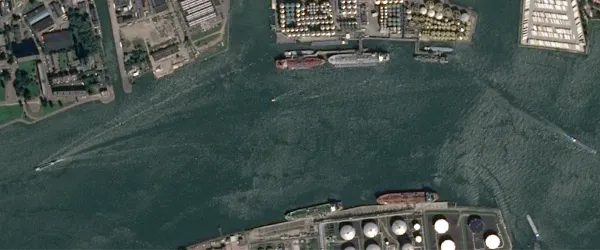
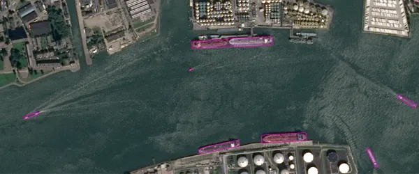
The algorithm uses object detection in SPOT display imagery to detect ships. The result is a GeoJSON file with polygons drawn around detected ships.
Ship detection can be used for maritime surveillance, port and harbor management, and fishing activity detection.
| Specification | Description |
|---|---|
| Provider | Airbus Agrimetrics |
| Process type | Analytics from 300 credits per km2 |
For optimal results, the algorithm must be used to detect ships larger than 26 m. You can use it to detect smaller ships, but the results might not be as accurate.
Scenarios represented in the training data:
- Different cloud coverage
- Different maritime conditions
Input data items must be added to storage in 2023 or later.
| Collection | Data product |
|---|---|
| SPOT | Catalog: Display |
Use the detection-ships-airbus name ID for the processing API.
A sample input payload for the process
{ "inputs": { "title": "Processing imagery over Berlin", "item": "https://api.up42.com/v2/assets/stac/collections/21c0b14e-3434-4675-98d1-f225507ded99/items/23e4567-e89b-12d3-a456-426614174000" }}| Parameter | Overview |
|---|---|
inputs.title | string | required The title of the output data item. |
inputs.item | string | required The absolute API path to the input data item. |