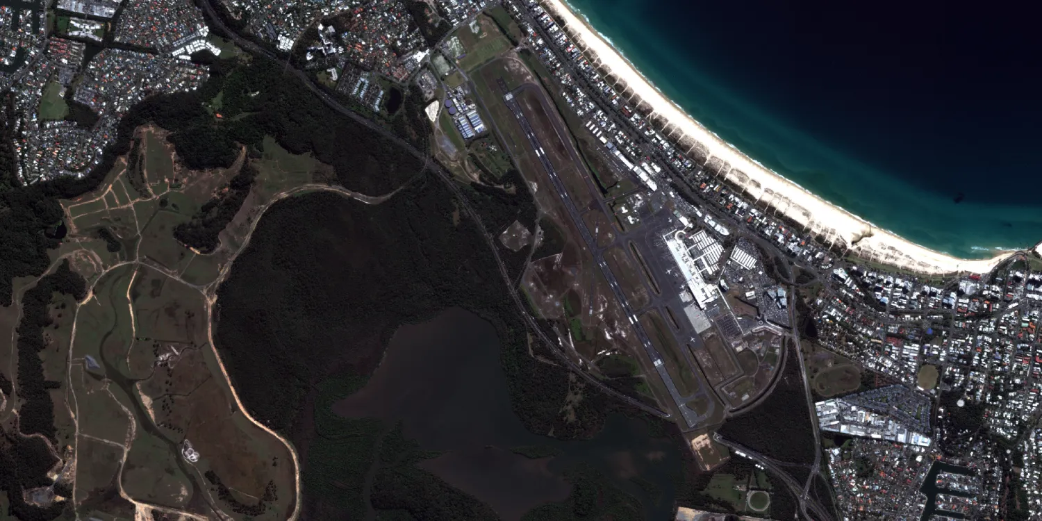
Maxar imagery is acquired by GeoEye-1, WorldView-2, WorldView-3, and the WorldView Legion satellites anywhere on the globe. Catalog datasets are available starting from 2001.
30 cm tasking
- WorldView Legion
- WorldView-3
50 cm tasking
- GeoEye-1
- WorldView-2
- WorldView-1

| Data product | Spectral bands combination | Order link |
|---|---|---|
| Custom (30 cm) |
maxar-30cm-tasking | b71c6628-38b4-4894-90cf-cfac9c746211 | |
| Custom (50 cm) |
maxar-50cm-tasking | 047bbc09-a0eb-44ff-97d5-722d6bc8951a |
| Data product | Spectral bands combination | Order link |
|---|---|---|
| WorldView Legion HD15 | 4-band: Pansharpened (RGB and NIR) API name and ID:worldview-legion-hd | 2cc490fa-0ef0-4920-afdd-1bcffc67a11f | |
| WorldView Legion — System-Ready | Bundle: 1 panchromatic and 8 multispectral bands (RGB, NIR, red edge, coastal blue, and yellow) API name and ID:worldview-legion-system-ready | a87b8a02-8c01-4252-b102-2321b49f0a7e | |
| WorldView Legion — Ortho-Ready | Bundle: 1 panchromatic and 8 multispectral bands (RGB, NIR, red edge, coastal blue, and yellow) API name and ID:worldview-legion-ortho-ready | 652ab31a-5332-4a2c-a967-adeb8b21c95f | |
| WorldView Legion — Map-Ready | Bundle: 1 panchromatic and 8 multispectral bands (RGB, NIR, red edge, coastal blue, and yellow) API name and ID:worldview-legion-map-ready | 1f126309-a31e-4cbe-9489-99a6db8cc04e | |
| WorldView Legion — Map-Ready Pansharpened | 8-band: Pansharpened (RGB, NIR, red edge, coastal blue, and yellow) API name and ID:worldview-legion-map-ready-pansharpened | 3ce206aa-598d-4eb1-beac-1129eb875845 | |
| WorldView-3 — System-Ready | Bundle: 1 panchromatic and 8 multispectral bands (RGB, NIR, red edge, coastal blue, and yellow) API name and ID:worldview-3-system-ready | 4007ab24-9835-4c15-b2ab-b50108b8e272 | |
| WorldView-3 — Ortho-Ready | Bundle: 1 panchromatic and 8 multispectral bands (RGB, NIR, red edge, coastal blue, and yellow) API name and ID:worldview-3-ortho-ready | b4d76d17-dd8e-4f58-aa54-6014171c3d76 | |
| WorldView-3 — Map-Ready | Bundle: 1 panchromatic and 8 multispectral bands (RGB, NIR, red edge, coastal blue, and yellow) API name and ID:worldview-3-map-ready | c8e06696-a7ad-4cb9-a949-bf8cfa1b292c | |
| WorldView-3 — Map-Ready Pansharpened | 8-band: Pansharpened (RGB, NIR, red edge, coastal blue, and yellow) API name and ID:worldview-3-map-ready-pansharpened | 086fceb1-1348-4edd-b235-850fd32dbf2b | |
| GeoEye-1 — System-Ready | Bundle: 1 panchromatic and 4 multispectral bands (RGB and NIR) API name and ID:geoeye-1-system-ready | f9e4091d-c047-430a-ba11-56beb629d39c | |
| GeoEye-1 — Ortho-Ready | Bundle: 1 panchromatic and 4 multispectral bands (RGB and NIR) API name and ID:geoeye-1-ortho-ready | 7228948b-8b39-4dfd-9699-a6a6abde0de4 | |
| GeoEye-1 — Map-Ready | Bundle: 1 panchromatic and 4 multispectral bands (RGB and NIR) API name and ID:geoeye-1-map-ready | 114c0df2-d856-4402-bd60-e22c56bc33fa | |
| GeoEye-1 — Map-Ready Pansharpened | 4-band: Pansharpened (RGB and NIR) API name and ID:geoeye-1-map-ready-pansharpened | 2b55675f-086a-43fd-9fab-70d1d51b2b62 | |
| WorldView-2 — System-Ready | Bundle: 1 panchromatic and 8 multispectral bands (RGB, NIR, red edge, coastal blue, and yellow) API name and ID:worldview-2-system-ready | 8d84d7be-cc36-4edc-a679-23e53b346e3a | |
| WorldView-2 — Ortho-Ready | Bundle: 1 panchromatic and 8 multispectral bands (RGB, NIR, red edge, coastal blue, and yellow) API name and ID:worldview-2-ortho-ready | 37f7137f-6870-4995-a287-456411494e61 | |
| WorldView-2 — Map-Ready | Bundle: 1 panchromatic and 8 multispectral bands (RGB, NIR, red edge, coastal blue, and yellow) API name and ID:worldview-2-map-ready | 3617973f-a022-4375-8185-6e90c974a7c9 | |
| WorldView-2 — Map-Ready Pansharpened | 8-band: Pansharpened (RGB, NIR, red edge, coastal blue, and yellow) API name and ID:worldview-2-map-ready-pansharpened | 723c1e8d-1d34-4bf4-a4d5-42688e72338b | |
| WorldView-1 — System-Ready | 1-band: Panchromatic API name and ID:worldview-1-system-ready | 60d6bec3-024c-467f-af36-5ba2110bdfdd | |
| WorldView-1 — Ortho-Ready | 1-band: Panchromatic API name and ID:worldview-1-ortho-ready | b3a2d58f-1e1d-4f49-ac7e-dfee83c8b7a5 | |
| WorldView-1 — Map-Ready (16-bit) | 1-band: Panchromatic API name and ID:worldview-1-map-ready-16bit | 22a4e6b0-0152-455c-9837-96b29fed217c | |
| WorldView-1 — Map-Ready (8-bit) | 1-band: Panchromatic API name and ID:worldview-1-map-ready-8bit | ae2e2969-ac1a-4a74-b849-59ca0903a606 |
| Specification | Description |
|---|---|
| Provider | Maxar |
| Collection type | Tasking from 3,000 credits per km2 Catalog from 1,350 credits per km2 |
| Product type | Multispectral |
| System type | Satellite |
| Specification | Description |
|---|---|
| Resolution |
Panchromatic: 50 cm |
| Bit depth per pixel | System-Ready: 16‑bit Ortho-Ready: 16‑bit Map-Ready: 16‑bit (WorldView-1 — Map-Ready: 8 or 16‑bit) Map-Ready Pansharpened: 8‑bit WorldView Legion HD15: 8‑bit |
| Delivery format | A ZIP file containing the following files:
|
| Masks | ROI |
| Primary | Georectified | Orthorectified | |
|---|---|---|---|
| Basic | with RPC | with RPC | |
| TOA | |||
| Surface reflectance | with RPC | ||
| Display | with RPC |
| Primary | Georectified | Orthorectified | |
|---|---|---|---|
| Basic | System-Ready with RPC | ||
| TOA | |||
| Surface reflectance | Ortho-Ready with RPC | Map-Ready | |
| Display |
|
| Specification | Description |
|---|---|
| Acquisition mode | Tasking:
Catalog: Mono |
| Incidence angle | From 5° to 45° |
| Off-nadir angle | From 5° to 45° |
| Tasking priority | Standard |
| Orbit | WorldView Legion: mid-inclination at 45° and sun-synchronous, at 518 km WorldView-3: Sun-synchronous, at 617 km GeoEye-1: Sun-synchronous, at 681 km WorldView-2: Sun-synchronous, at 770 km WorldView-1: Sun-synchronous, at 496 km |
| Number of satellites | 9+ |
| Revisit rate | 15 times a day |
| Swath width | WorldView Legion: 10 km WorldView-3: 13.1 km GeoEye-1: 15.3 km WorldView-2: 16.4 km WorldView-1: 17.7 km |
| Specification | Description |
|---|---|
| Spectral bands |
Panchromatic: 400–900 nm |
| Specification | Description |
|---|---|
| Coordinate reference system | UTM-WGS84 |
| Positional accuracy | < 5 m CE90 absolute |
| Specification | Description |
|---|---|
| Limitations | Input: AOI from 25 km2 up to 1,000 km2, at least 2 km wide, with vertices spaced at least 2 meters apart Cloud coverage: 15–50% Output:
|
| Minimum charge | Mono: As per 25 km2 Stereo: As per 50 km2 |
| Specification | Description |
|---|---|
| Limitations | Input: AOI from 1 km2 up to 1,000 km2, at least 250 m wide Availability: From 2007 Output:
|
| Minimum charge | As per 1 km2 |