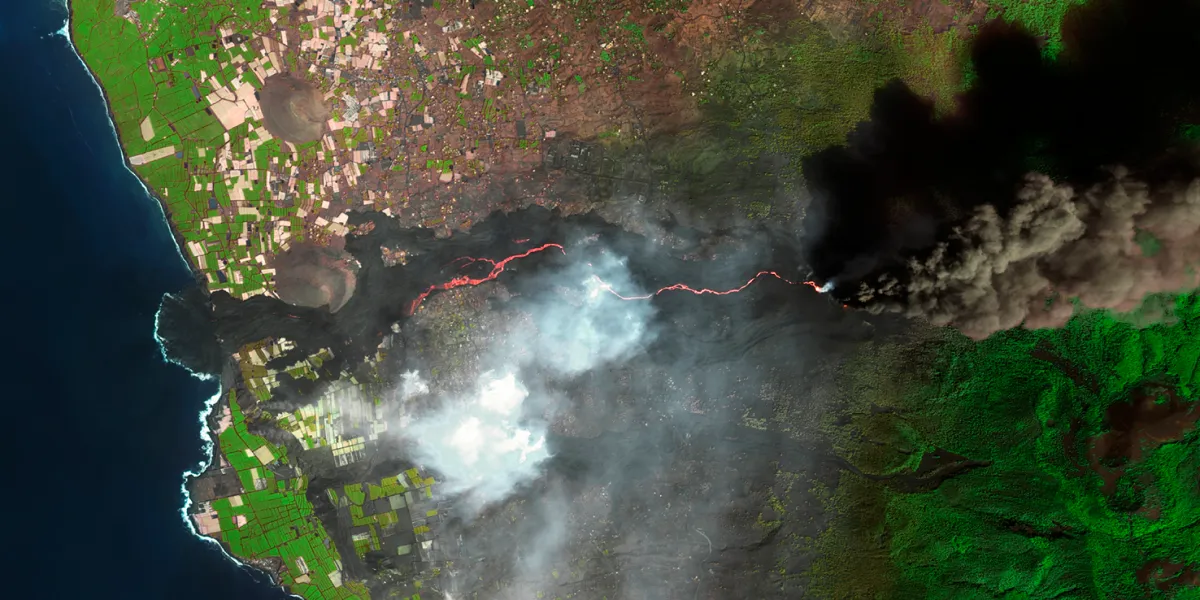
GEOSAT 2 images are acquired by a very high resolution multispectral satellite every 2 days anywhere on the globe.

| Data product | Spectral bands combination | Order link |
|---|---|---|
| Custom |
geosat-2-tasking | 1a895ee6-85c5-48ff-b5bc-3dcf35e117ee |
| Data product | Spectral bands combination | Order link |
|---|---|---|
| Bundle (PM4) | Bundle: 1 panchromatic and 4 multispectral bands (RGB and NIR) API name and ID: Not integrated | |
| Pansharpened (PSH) | 4-band: Pansharpened (RGB and NIR) API name and ID: Not integrated | |
| Pansharpened True Color (PS3) | 3-band: Pansharpened true color (RGB) API name and ID: Not integrated | |
| Pansharpened False Color (PS4) | 3-band: Pansharpened false color (RG and NIR) API name and ID: Not integrated | |
| Panchromatic (PAN) | 1-band: Panchromatic API name and ID: Not integrated | |
| Multispectral (MS4) | 4-band: Multispectral (RGB and NIR) API name and ID: Not integrated | |
| Stereo Pair (STP) | Bundle: 1 panchromatic and 4 multispectral bands (RGB and NIR) API name and ID: Not integrated |
| Specification | Description |
|---|---|
| Provider | GEOSAT |
| Collection type | Tasking from 1,000 credits per km2 Catalog from 600 credits per km2 |
| Product type | Multispectral |
| System type | Satellite |
| Specification | Description |
|---|---|
| Resolution | Available resolutions:
|
| Bit depth per pixel | 8-bit |
| Delivery format | ZIP file containing the following files:
|
| Masks | Transparency |
| NoData value | 0 |
| Primary | Georectified | Orthorectified | |
|---|---|---|---|
| Basic | |||
| TOA | Orthoready* | Ortho* | |
| Surface reflectance | |||
| Display |
*Upon request.
| Specification | Description |
|---|---|
| Acquisition mode | Mono Stereo |
| Incidence angle | Up to 45° |
| Tasking priority | Standard |
| Orbit | Sun-synchronous, at 620 km |
| Number of satellites | 1 |
| Revisit rate | Every 2 days |
| Swath width | 12 km |
| Specification | Description |
|---|---|
| Spectral bands | Panchromatic: 560–900 nm Multispectral:
|
| Specification | Description |
|---|---|
| Coordinate reference system | UTM-WGS84 |
| Positional accuracy | < 20 m CE90 absolute |
| Specification | Description |
|---|---|
| Limitations | Input: AOI at least 5 km wide Cloud coverage: 0–100% Output: AOI-clipped imagery |
| Minimum charge | As per 25 km2 |
| Specification | Description |
|---|---|
| Limitations | Input: AOI at least 5 km wide Availability: From 2014 Output: AOI-clipped imagery |
| Minimum charge | As per 25 km2 |
The geographic coverage is global.