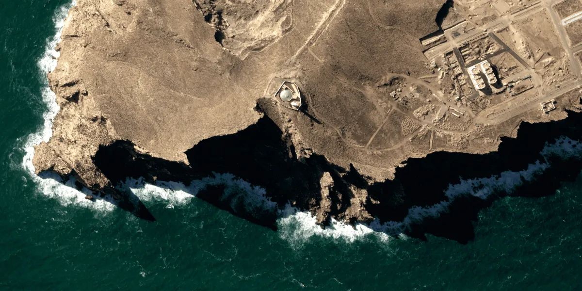
Pléiades Neo imagery is acquired by very high resolution optical satellites (Pléiades Neo 3 and 4) daily anywhere on the globe. Catalog datasets are available starting from November 2021. See more on the marketplace or download sample data.

The geographic coverage is global, but certain areas are restricted.
The restriction map
| Data product | Type | Spectral bands combination |
|---|---|---|
| Custom | Tasking | Available band combinations and bundles
|
| Analytic | Catalog | Bundle: 1 panchromatic and 6 multispectral bands (deep blue, RGB, red edge, and NIR) Analytic has a more stable contrast and can be used to extract physical properties, such as radiance or reflectance — for example, in vegetation health monitoring. |
| Pansharpened Reflectance | Catalog | 6-band: pansharpened (deep blue, RGB, red edge, and NIR) Pansharpened Reflectance is a pansharpened Analytic image with a multispectral Look-Up-Table containing rendering of color curves. |
| Display | Catalog | 6-band: pansharpened (deep blue, RGB, red edge, and NIR) Display has a true color curve applied on top of atmospheric correction. As a result, it looks better visually and can be used to extract features — for example, in car detection or infrastructure monitoring. |
| Pléiades Neo HD15 Ortho | Catalog | 3-band: pansharpened (RGB) Pléiades Neo HD15 provides an image with enhanced colors and sharper details for clearer interpretation. |
| Basic Primary | Catalog* | Available band combinations and bundles
|
| Basic Projected | Catalog* | Available band combinations and bundles
|
| Basic Ortho | Catalog* | Available band combinations and bundles
|
| Reflectance Primary | Catalog* | Available band combinations and bundles
|
| Reflectance Projected | Catalog* | Available band combinations and bundles
|
| Display Primary | Catalog* | Available band combinations and bundles
|
| Display Projected | Catalog* | Available band combinations and bundles
|
*This data product isn’t integrated into the platform and can only be ordered upon request.
The tasking capabilities of this collection might require a feasibility study. However, a specific combination of parameter values bypasses that requirement. If input geometry limitations are met, an order with this combination will proceed to the activation request stage after creation.
The combination of parameter values
| Parameter | Value |
|---|---|
| Minimum interval | At least 30 days |
| Acquisition mode | Mono |
| Cloud coverage | From 10% to 20% |
| Incidence angle | From 20% to 50% |
| Specification | Description |
|---|---|
| Provider | Airbus |
| Collection type | Tasking Catalog |
| Product type | Optical |
| System type | Satellite |
| Specification | Description |
|---|---|
| Resolution | HD15: 15 cm Panchromatic: 30 cm Pansharpened: 30 cm Multispectral: 1.20 m |
| Bit depth per pixel | Tasking:
|
| Delivery format | A ZIP file containing the following files:
|
| Masks | Cloud Quality ROI Transparency Water |
| NoData value | 0 |
| Primary | Georectified | Orthorectified | |
|---|---|---|---|
| Basic | with RPC | ||
| TOA | |||
| Surface reflectance | with RPC | ||
| Display | with RPC |
| Primary | Georectified | Orthorectified | |
|---|---|---|---|
| Basic | Basic Primary* with RPC | Basic Projected* | Basic Ortho* |
| TOA | |||
| Surface reflectance | Reflectance Primary* with RPC | Reflectance Projected* | Analytic Pansharpened Reflectance |
| Display | Display Primary* with RPC | Display Projected* | Display Pléiades Neo HD15 Ortho |
*Upon request.
| Specification | Description |
|---|---|
| Acquisition mode | Tasking:
|
| Incidence angle | From 5° to 50° |
| Off-nadir viewing angle | 30° |
| Tasking priority | Standard High |
| Orbit | Sun-synchronous, at 620 km |
| Number of satellites | 2 |
| Revisit rate | 2 times a day |
| Catalog refresh rate | 2 times a day |
| Swath width | 14 km |
*Upon request.
| Specification | Description |
|---|---|
| Spectral bands | Panchromatic: 450–800 nm Multispectral:
|
| Specification | Description |
|---|---|
| Coordinate reference system | Tasking:
|
| Positional accuracy | Tasking and catalog standard: 5 m CE90 absolute at nadir Catalog advanced: < 3.5 m CE90 absolute at nadir |
| Specification | Description |
|---|---|
| Limitations | Input: AOI from 5 km2 and at least 5 km wide (maximum bounding area for high priority orders: 13×30 km2) Cloud coverage (depending on the priority):
|
| Minimum charge | As per 100 km2 |
| Specification | Description |
|---|---|
| Limitations | Input (AOI, depending on the asset delivery time):
Output: AOI-clipped imagery |
| Data product | Type | Name and ID | Collection name |
|---|---|---|---|
| Custom | Tasking | Name: pneo-taskingID: 07c33a51-94b9-4509-84df-e9c13ea92b84 | pneo-tasking |
| Analytic | Catalog | Name: pneo-analyticID: 6f722fb5-0323-4c97-9b1e-22870325b8db | pneo |
| Pansharpened Reflectance | Catalog | Name: pneo-pansharpened-reflectanceID: 29f4ff62-9d05-483f-994b-75142ed202de | pneo |
| Display | Catalog | Name: pneo-displayID: 17745de8-6e7d-4751-99cd-3f8e9e9d290e | pneo |
| Pléiades Neo HD15 Ortho | Catalog | Name: pneo-hd15ID: 66a7e14d-0b62-45e0-a3d7-fb2cfce62cc8 | pneo-hd15 |
In a standard delivery, an IMG_ directory contains imagery and uses file naming conventions to indicate the spectral processing of the delivered data product.
| Naming convention | Description |
|---|---|
_MS | Analytic multispectral assets |
_PAN | Analytic panchromatic assets |
_PMS | Display assets |